Practice: Task 1 - Bản đồ (2026)
Updated: September, 2026

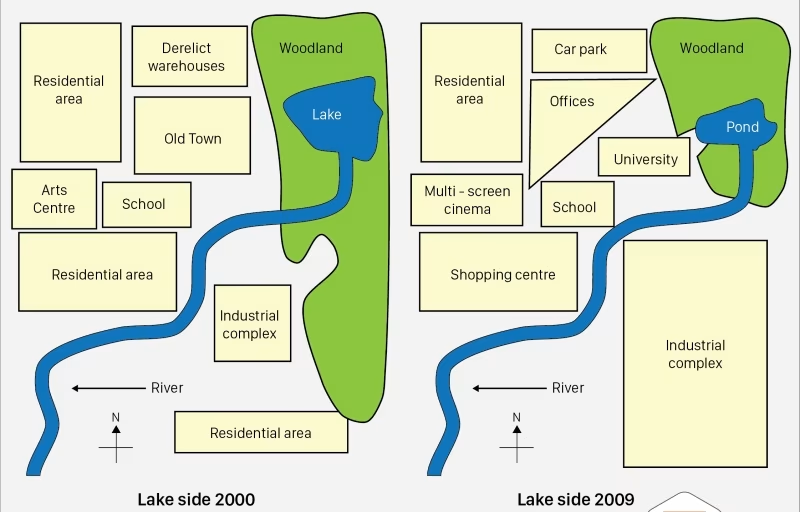
Đề 1: The map below shows the changes of Lakeside from 2000 to 2009.
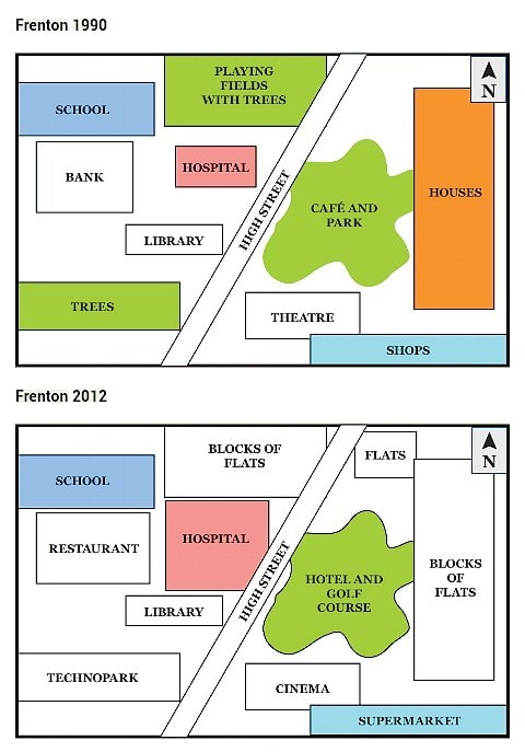
Đề 2: The given maps show the changes of Frenton from 1990 to 2012.
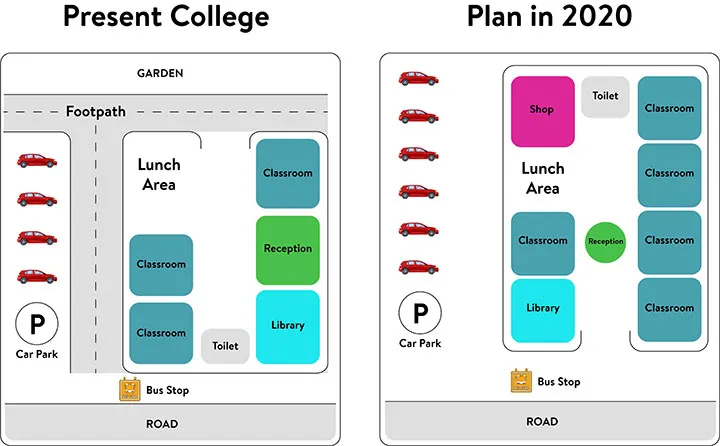
Đề 3: The present building of a college and the plan for changes to the college site in the future.
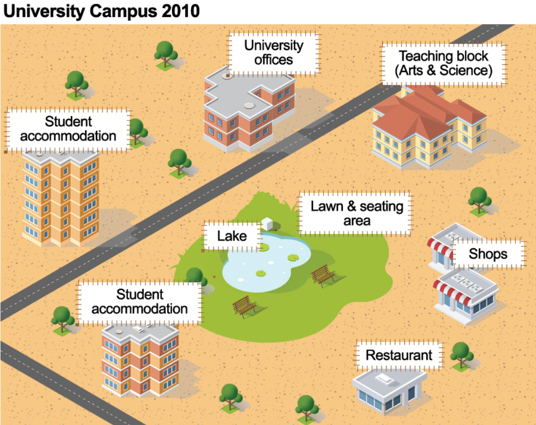
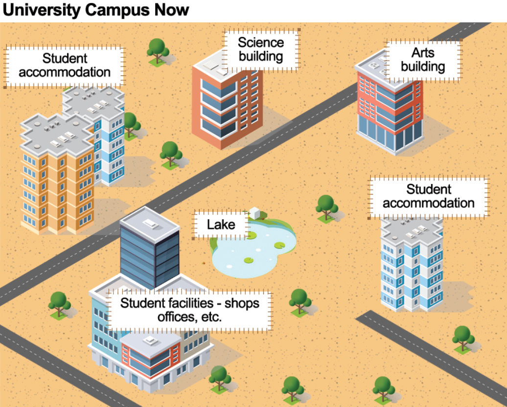
Đề 4: The maps show improvements that have been made to a university campus between 2010 and the present day.
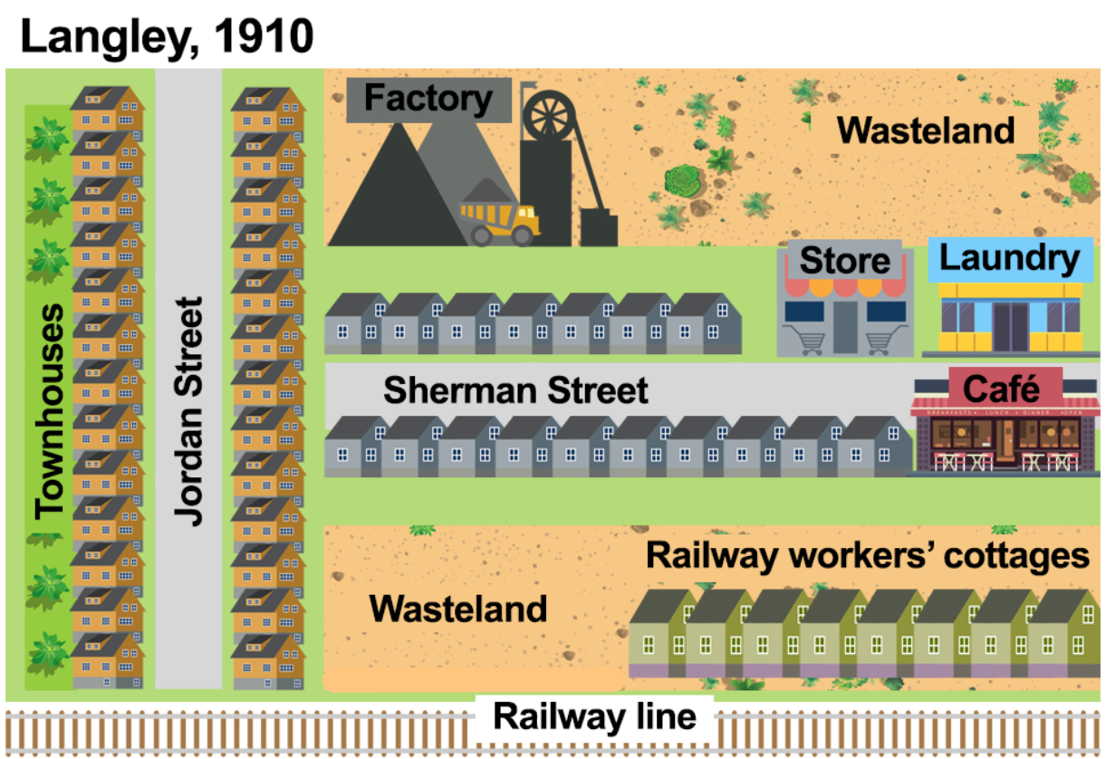
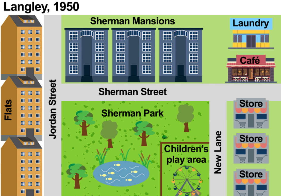
Đề 5: The maps show the town of Langley in 1910 and 1950.
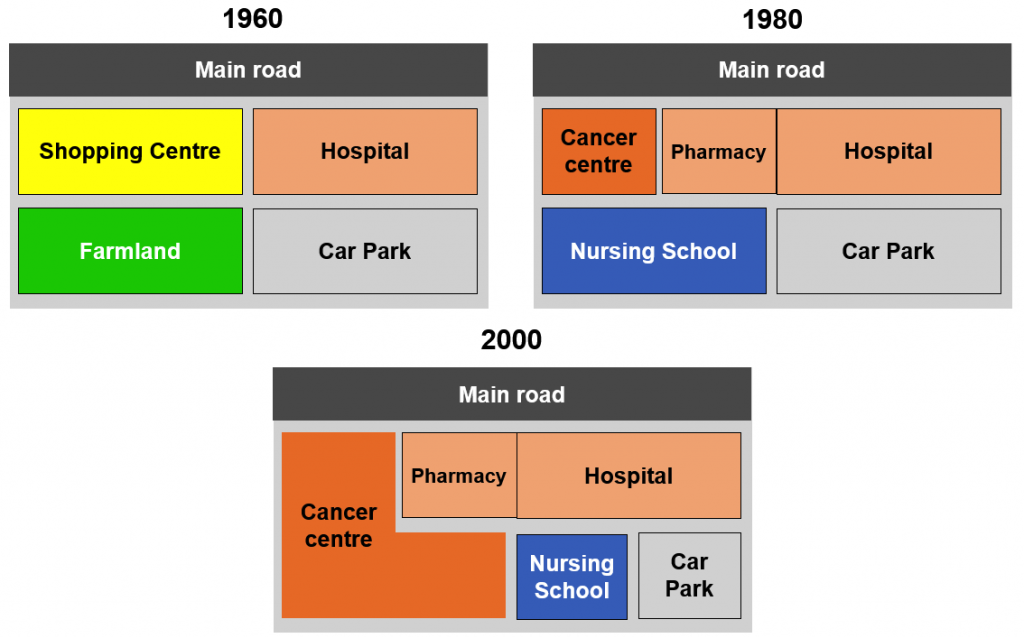
Đề 6: The maps below show the changes that have taken place at Queen Mary Hospital since its construction in 1960
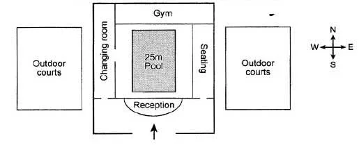
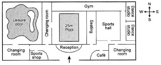
Đề 7: The plans below show the layout of a university’s sports centre now, and how it will look after redevelopment.
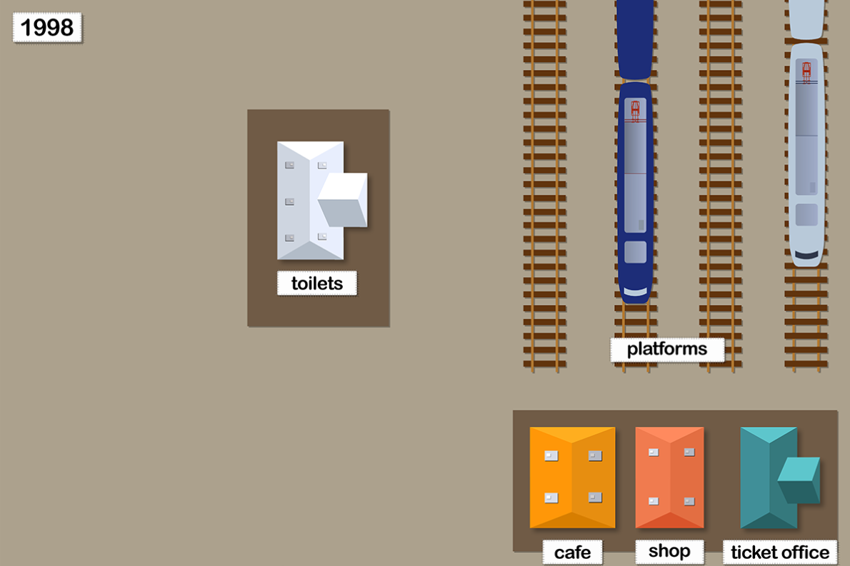
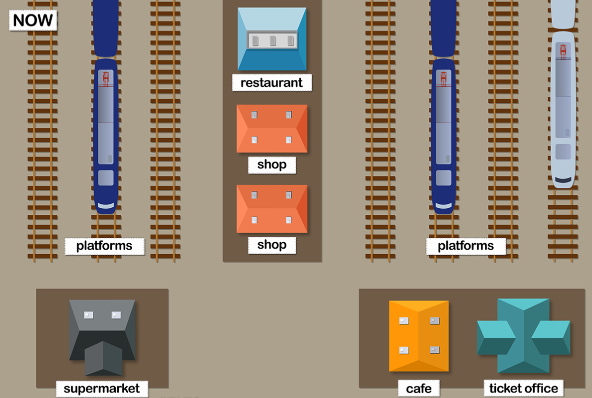
Đề 8: The maps show Pacific Railway Station station in 1998 and now.
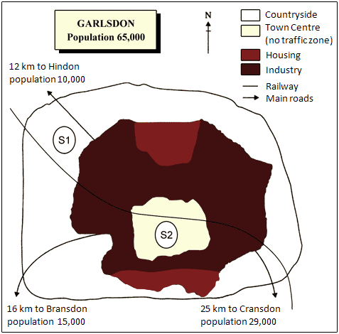
Đề 9: The map below is of the town of Garlsdon. A new supermarket (S) is planned for the town. The map shows two possible sites for the supermarket.
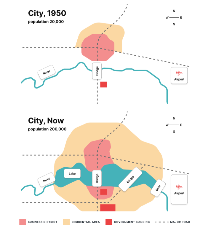
Đề 10: The maps below show a plan of a city in 1950 and at the present.
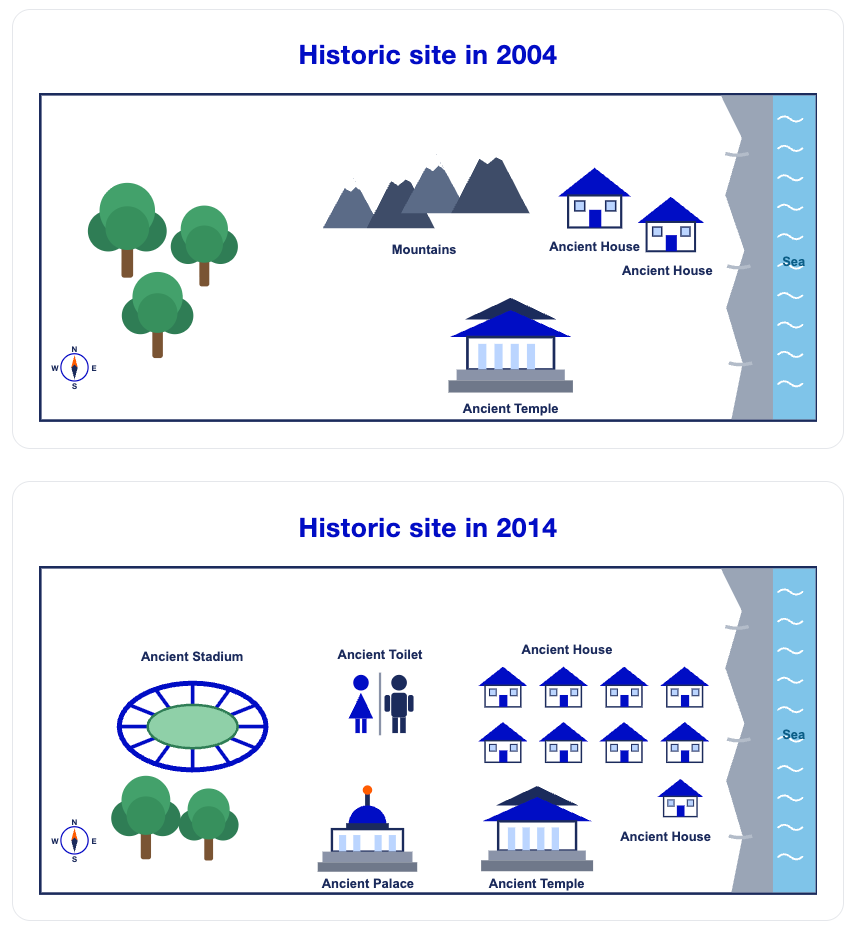
Đề 11: The maps below show recent archaeological findings at a historic site in 2004 and 2014.
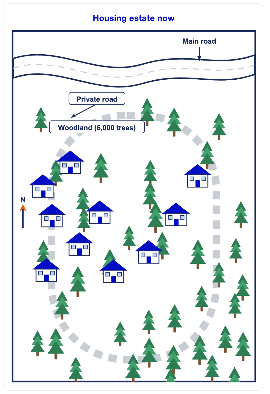
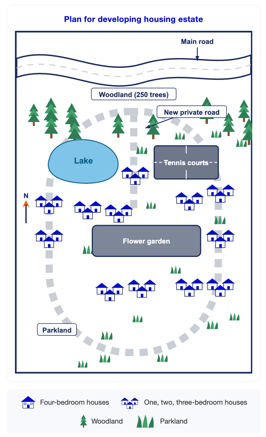
Đề 12: The maps below show a housing estate as it is now and a plan for developing it in the future.
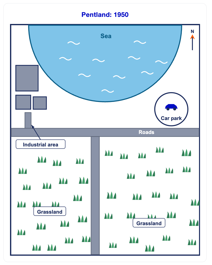
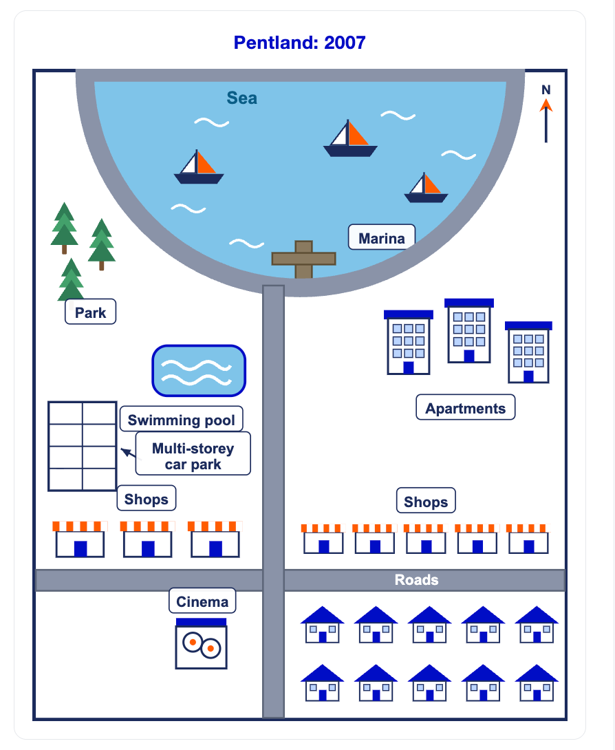
Đề 13: The diagrams below show the changes that took place in a coastal area called Pentland between 1950 and 2007.
Đề 14. The diagram below illustrates the current layout and proposed development of the biomedical campus at a university. 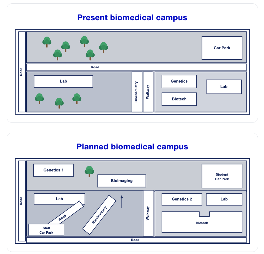
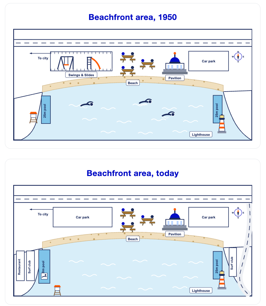
Đề 15. The maps below show a beachfront area in Australia in 1950 and the same area today.

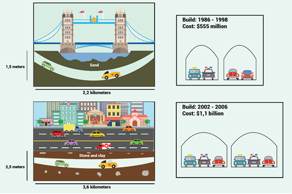
Đề 16. The diagrams give information about two road tunnels in two Australian cities.